|
Your Ultimate Offline Guide to Algonquin Park
|
|
We're excited to officially launch the new Algonquin Park App, created by Backroad Maps in partnership with Algonquin Outfitters.
Designed specifically for one of Canada's most iconic outdoor destinations, the app combines detailed offline maps, local adventure information and powerful navigation tools into one easy-to-use experience.
Whether you're planning a weekend camping trip, paddling route, fishing adventure or backcountry expedition, the Algonquin Park App helps you discover more of the park, even far beyond cell coverage.
|
What You'll Love
|
|
✓
|
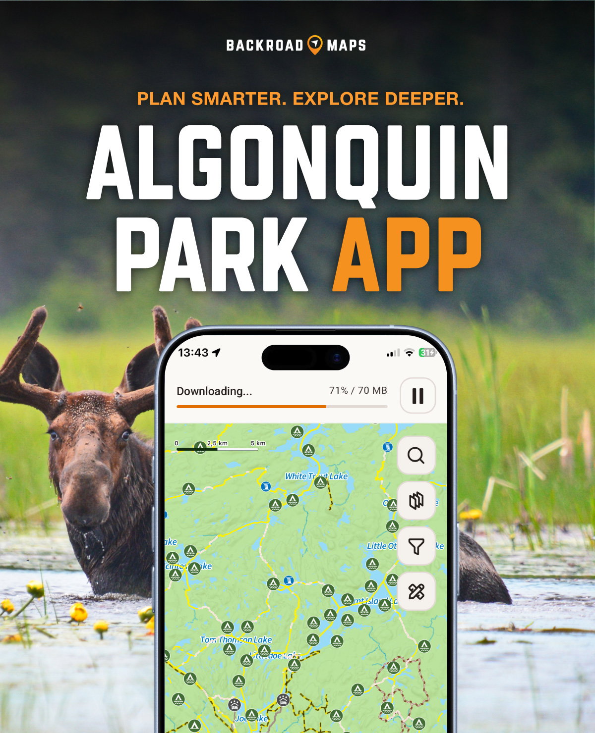
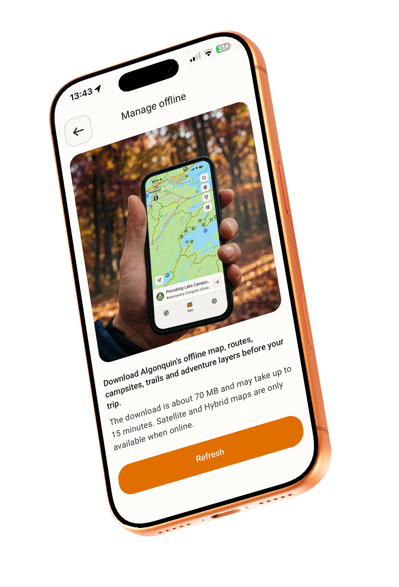
Offline When It Counts
Algonquin Park is vast, rugged and remote. Outside the Highway 60 corridor, cell service quickly becomes unreliable or disappears entirely. The app is built for real exploration with detailed offline maps that continue working wherever your adventure takes you. Download maps before your trip and confidently navigate trails, lakes, campsites and access points without needing a signal.
|
|
|
|
|
|
✓
|
Built Specifically for Algonquin Park
This app was designed specifically for the unique terrain, routes and recreation opportunities found throughout the park, including hyper-local information, park regulations and trip-planning tools tailored to Algonquin adventures.
|
|
|
|
✓
|
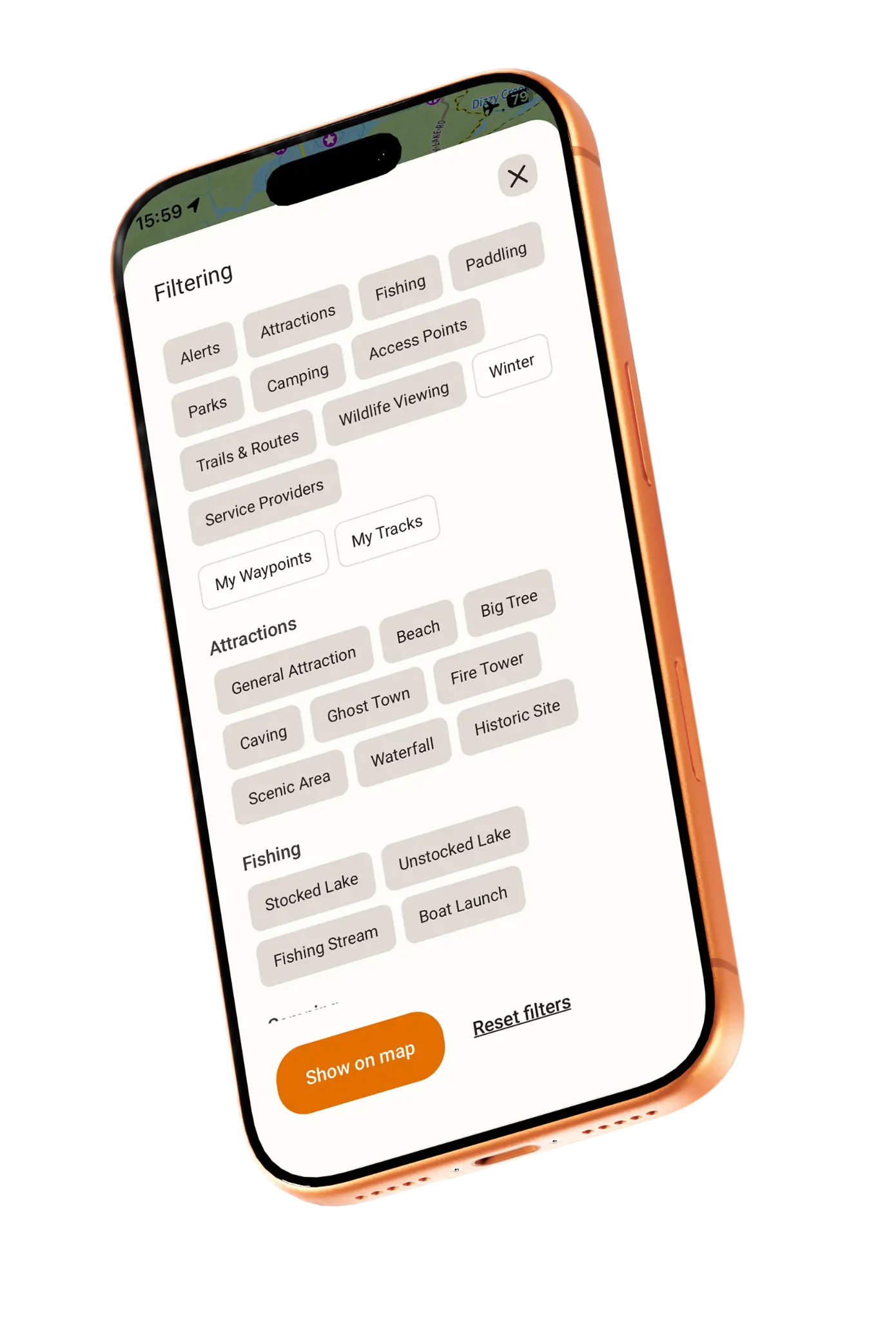
Smart Filters and Adventure POIs
Customize your map experience with powerful filters and discover thousands of adventure points of interest, campsites, trails, routes, and hidden gems throughout the park.
|
|
|
|
|
✓
|
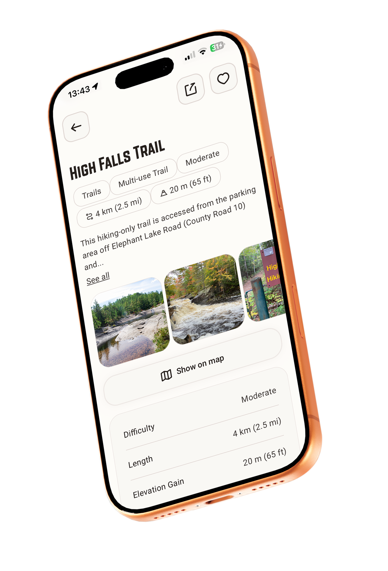
Detailed Information for Every Adventure
Each point of interest includes detailed written descriptions created by the Backroad Maps team of outdoor writers and researchers, including access, difficulty, species, tips and recommendations.
|
|
|
|
|
|
|
|
|
|
|
|
Two Tools. One Complete Algonquin Experience.
|
|
Exploring Algonquin works best when big-picture planning and detailed navigation work together.
The Algonquin Provincial Park Recreation Map and the Algonquin Park App are designed to complement each other, giving you clarity before you go and confidence once you are inside the park.
|
Use the Recreation Map to:
|
✓ Plan routes and trip logistics
|
|
✓ Understand the overall layout of the park
|
|
✓ Navigate at camp or on the water
|
|
✓ Get a broad overview of lakes, roads and recreation opportunities
|
|
|
Use the Algonquin Park App to:
|
✓ Access precise GPS navigation
|
|
✓ Track your hikes, paddles and routes
|
|
✓ Discover detailed points of interest
|
|
✓ Filter adventures and activities in real time
|
|
✓ Access detailed offline information throughout the park
|
|
|
|
Together, they create a complete planning and navigation system for Algonquin Park, without relying on cell service.
|
|
|
|
Happy adventuring,
|
|
The Backroad Maps Team
|
© 2026 Backroad Maps
106 - 1500 Hartley Ave, Coquitlam, BC V3K 7A1
|
|